


Simple Model Outperforms LightGBM in Predicting Police Incidents in Lima
A study using open data from Lima tests whether urban environment features improve daily predictions of registered incidents across 2,120 cells.
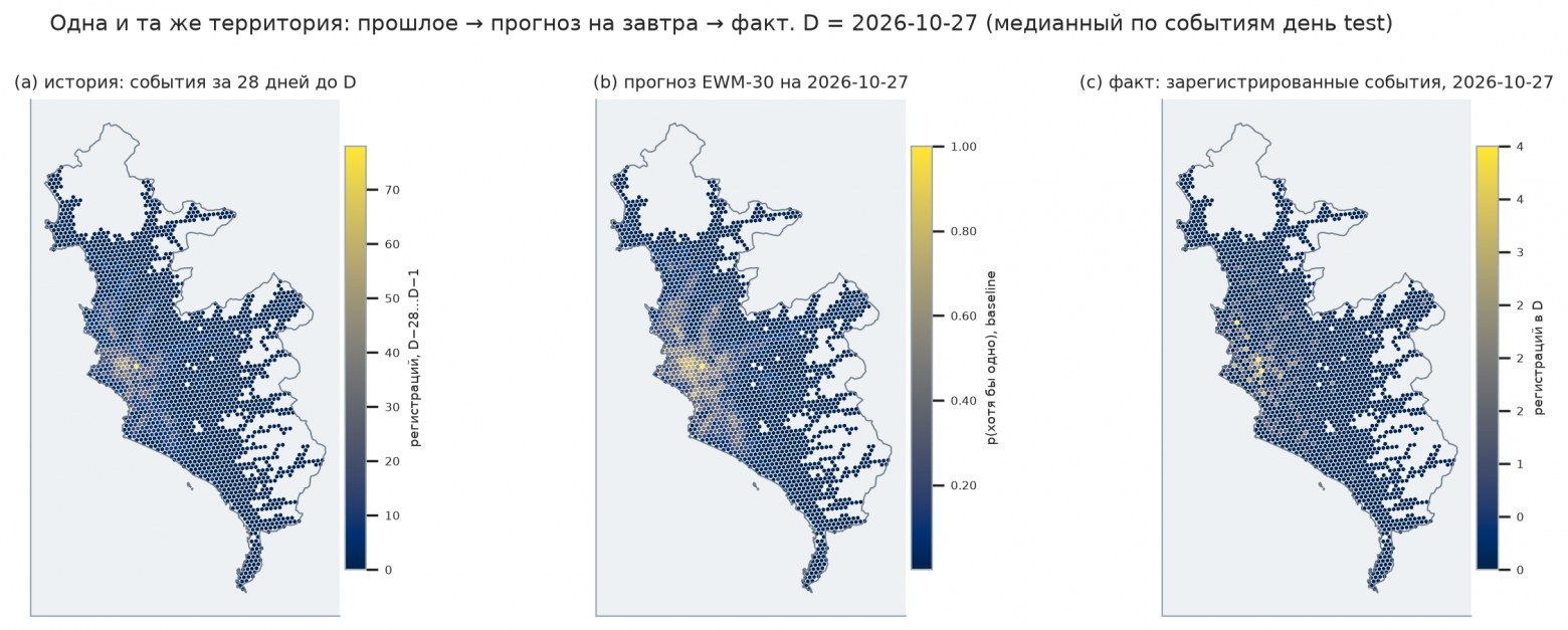
The model does not estimate exact coordinates but rather the probability of an incident being registered in each cell for the following day. The territory is divided into H3 hexagons, which serve as the model's coverage of Lima rather than administrative districts. The calculations include the history of police reports, calendar features, and characteristics of the urban environment—points of interest, buildings, and the street network from OpenStreetMap.
Incident data is sourced from the public SIDPOL layer published by the Ministry of the Interior of Peru. The study accounts only for registered events with known coordinates. Thus, the indicators reflect not only criminal activity but also residents' reporting behavior and registration specifics. Domestic violence is excluded from the analysis as a separate process with different geography; fraud and extortion are categorized independently since the coordinates may refer to the complainant's address.
The authors compared models against historical benchmarks. The best simple option was EWM-30—a smoothed estimate in which more recent incidents carry greater weight. In the top 5% of cells, this variant covered 41.2% of incidents during the test period. Additionally, LightGBM models were tested: one used historical and calendar data, another added urban features, and a third adjusted the baseline EWM-30 estimate.
Urban data helps describe the cell's surroundings but does not, on its own, prove the causes of criminal activity. Furthermore, the OpenStreetMap snapshot from 11.11.2026 was taken after the test period concluded. Therefore, the results of models incorporating such features cannot be considered entirely protected from temporal leakage: a historical OSM snapshot and a reassessment are needed for final validation.